|
|
Untitled Document
| |
Bogor District |
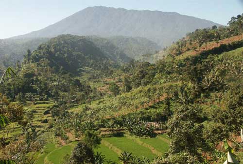
Bogor district, a short drive from Jakarta , offers routes in forest, tea gardens, rice paddies, and kampong at the foot of Mt. Pangrango . Two sectors have been mapped so far: |
|
| |
The Ciawi sector (B) lies above the end of the toll road and offers the following 4 circle routes:
• B1 Nangleng (7.5km), a good route for beginners with easy navigation, traverses some good forest as well as rice paddies and dry fields, and climbs to 960m. This route can be downloaded from this site as a free sample.
• B2 Pancawati (12.3km) traverses extensive forest together with dry fields and climbs to 1348m.
• B3 Cibedug (6.8 km) traverses three valleys going and coming, by way of rice paddies, dry fields, some forest and kampong. The trail climbs to 760m.
|
 |
• B4 Arca (6.6km) traverses rice paddies, dry fields and some forest. The trail climbs to 911m and passes through a historic German military cemetery, the history of which is told in the guidebook. |
 |
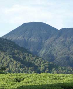
The Cisarua sector (C) lies above the Puncak highway (which climbs from the Cisarua market to the Gunung Mas tea gardens and Puncak pass). It offers hiking at higher elevations than in Ciawi. The circle routes are:
• C1 Citeko (8.9km), a good route for beginners with easy navigation, traverses tea gardens and dry fields. There is a 40m waterfall. The route climbs to 1342m.
• C2 Sampai (6.9km), another good route for beginners, traverses the Gunung Mas tea gardens, climbs to 1258m.
• C3 Mandalawangi (11.1km), traverses extensive forest as well as tea gardens. It is perhaps the most challenging route in the entire series, with the most diverse bird life. The route climbs from 1136m to 1862m, so be prepared for a stiff climb.
|
• C4 Gunung Gedogan (9.3km), traverses forest and tea gardens, climbing to 1626m. |
| [Copyright ©by Alex Korns] |
|
|